THE BIG SOUTHERN BUTTE FIRE LOOKOUT
- deadheadcutflowers
- Oct 24, 2023
- 3 min read

The Bureau of Land Management announced plans for a fire lookout atop the Big Southern Butte in 1962. The BLM expected a heavy fire season due to heavy winter snowfall and consequent lush plant growth, and would have a temporary lookout that summer, the permanent one (in photo above) to be finished the following year.
The Big Southern always served as a focal point on the desert, towering two thousand feet above the surrounding landscape. Accounts from the Hudson's Bay company and the Mormons heading north regularly mentioned it as a feature in their reports. Stage routes used it as a compass point and a small spring on its north side provided the only water within twenty miles when the Lost River was dry. It likely, however, was rarely scouted from its pinnacle.
In late June of 1910, a party of a hundred people took an excursion to Arco for a baseball game, with some parties stopping along the way to fish the Lost and another heading to the Big Southern, first to investigate possible farming sites to its west (which they found unsuitable) and then to climb to its top.
They took their horses up the south side but found it hard going about 1500 feet up, so one man took their rides back down and the others climbed to the summit. They saw a monument there denoting the separation between Blaine County and Bingham (there was no Butte County at that time), and noticed "streaks of oxide" that had been prospected but abandoned. They noted the presence of chokecherries, serviceberries, wild raspberries, butterflies, sparse pine and quaking aspen growth, the sparseness due to a fire that roared through two decades before. Other than that, they said there was not much more than a fine view of the surrounding terrain.
Jas. Murray's station at the bottom of the Butte had just changed hands, bought by Holland and Zetchie, the new buyers' intent to make improvements that included piping water from a source about a mile up on the Butte. That stage house burned down a year later, leaving the closest place for travelers to stay nearly ten miles away, at Powell. In 1912, Holland was on the hunt for a nearby bear that was haunting the area and harassing his cattle, promising steaks for everyone when he killed it.
Fires regularly swept through the Snake River Plain, with a twenty thousand acre inferno near the Nuclear Testing Facility by the Butte in late July of 1964 and a hundred thousand acre blaze two years later south of the Butte. In 1969, the Navy used the Butte as a gun range, to test 17 weapons, with 16 inch barrels, that would be used aboard battleships.

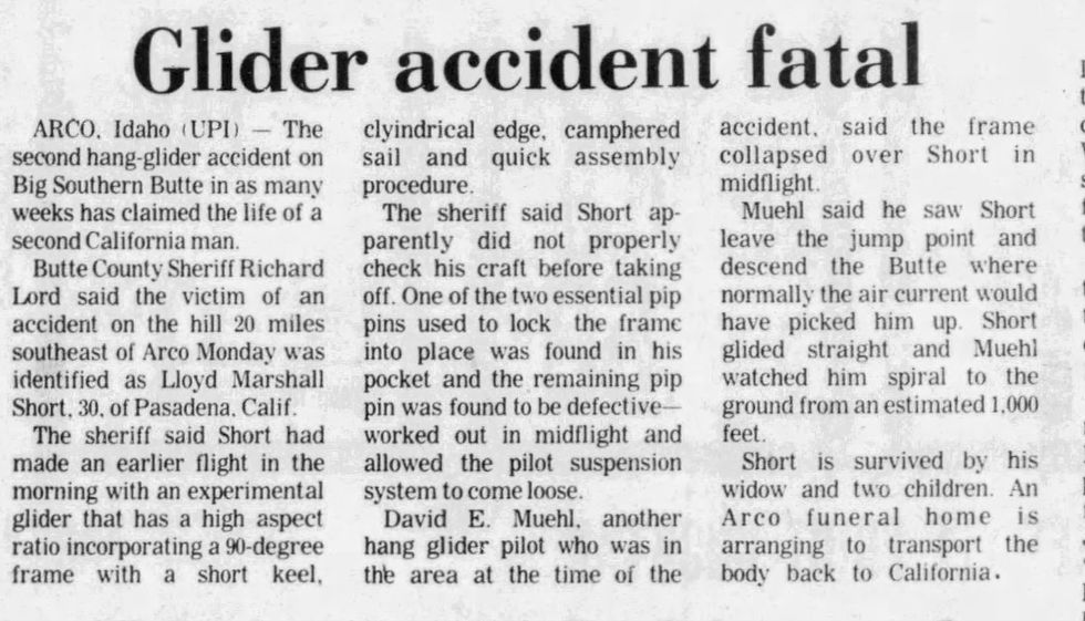
Hang gliding became a feature of the Big Southern in 1974, with two chutists dying in a period of two weeks, one spiralling a thousand feet to the ground when his suspension failed. He left a widow and two children.

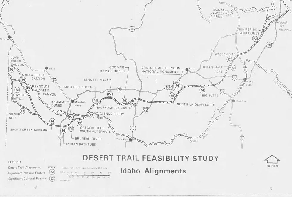
A desert trail feasibility study was underway in 1978. It would pass through much of the Snake River Plain, passing the Big Southern after coming clear from Island Park and eventually reaching the Owyhees in Western Idaho. An effort to make a Great Rift Wilderness area encompassing the Ice Caves, Craters of the Moon and the Big Southern took place in the following years without success.

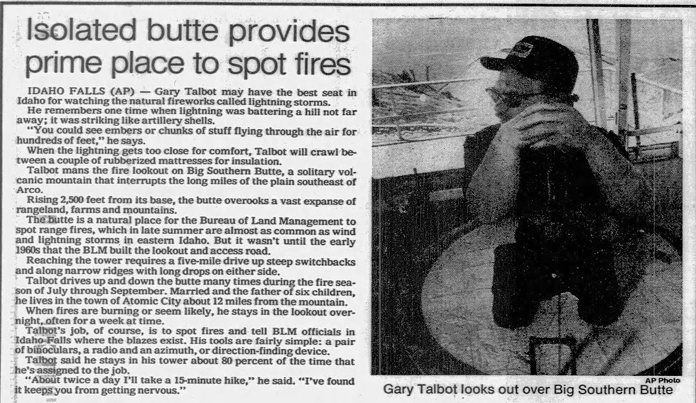
Gary Talbot, who lived at Atomic City with his wife and six children, manned the Big Southern lookout in 1883. He recalled witnessing lightning strikes with "embers and chunks of stuff flying through the air for hundreds of feet." For protection during such events, he crawled between two rubberized mattresses.

In 1996, a 216,000 acre blaze threatened the Nuclear Facility and the lookout, as well as farmsteads and fields and power lines. Fire retardant was dropped to protect the structure from an extensive fire, with eighty fire fighters and a dozen dozers digging firelines to keep it from spreading.
The station was still used in 2002, though new technologies were appearing that would make the lookout obsolete. Atomic City resident Ron Brown had manned the lookout for the prior three summers, looking for smoke columns eight hours a day. He could see sixty miles in all directions, on a clear day spying Utah, Wyoming and Montana. He wasn't too concerned about lightning or fires, but the wind was disturbing, regularly hitting 30-40 mph and easily gusting to 80 mph.

In 2013, the structures were removed, though a road--traversable by a UTV--still exists to the top.
Ralph Thurston is the author of The Shanghi Plain: Bingham County's Early History, available at Kesler's Market in Blackfoot and online at https://www.amazon.com/dp/B0CCCS7XLR?ref_=pe_3052080_397514860
(For bulk or classroom pricing, contact the author)

Comments